Ancient maps of Belarusian land are displayed at the Visual Images of Historical Memory exhibition
 Belarus is a country with a rich history. In the Middle Ages, Belarusian lands were the centre of the Grand Duchy of Lithuania, and after that were part of Rzech Pospolita, one of the largest European states of that time.
The TSEX gallery decided to exhibit memorable milestones in Belarusian history. It became not only historical exhibition, but also a lesson of geography, with reflexions about the place of Belarus in Europe and in the world as a whole.
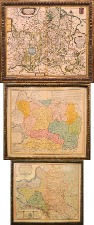
Near the gallery entrance, one could hear the melodies of ancient music creating a special atmosphere of the Middle Ages. In the exhibition hall there were works made in the style of classical Dutch paintings, more similar to pictures of well-known masters, than to maps of the region. One could stand by each exhibit for more than one hour, studying the details, both geographical and artistic.
 For example, in the map of 1689, the world on it is represented in the form of two hemispheres. On the left part, the map is decorated by pictures of terrestrial life. A heroic battle scene is painted above. Peering into the map, we find the capital of the ancient Belarusian state — Vilno.
We go further back to the Ebstorf Map of the 13th century; one of the most valuable artefacts which remains today. Its original size was 3.5 by 3.8 metres! Searching the reproduction, we find on the map the most ancient Belarusian city — Polotsk. Near to it is the river Niemen.
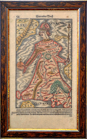
No less interesting is the original Queen of Europe map of 1398. Why is it special? This map gave rise to the vogue for allegorical maps in the form of human figures, outlines of animals or plants. On the image, we see that Belarusian lands are an integral part of the ‘body’ of Europe. Moreover, our territories, as part of the Rzech Pospolita, are located on ‘feet’ of the continent, on which stands all Europe…
Having talked to the curators of the exposition, we learn that this is Belarus’ first historical cartography exhibition. As the opening day showed, visitors showed great interest in the theme. We will hope that we can soon see new, as yet, unknown artefacts of the past which will tell us even more about Belarus. After all, without knowledge of our history it is impossible to see the future.


